If I build an ADS-B base station, what data can I get?
What does the real-time data on flightaware.com specifically refer to?

If I build an ADS-B base station, what data can I get?
What does the real-time data on flightaware.com specifically refer to?
This should help: https://flightaware.com/adsb/faq#datafeed
Having your own station is actually much more interesting than I would have thought.
First, you get a free enterprise account on FlightAware and can do inquiries, get alerts, etc, that others have to pay a lot to get.
But more than that, if you have an airport in range, you can watch airport operations. I can watch planes taxi, pull off for runups, take off, fly patterns, etc. Medical helicopters flying to/from local hospitals.
You see the raw tracks of all planes your station sees - even those who have blocked access to that information to the general public. You see police and state police helicopter ops. You see just about everything in the skies around you.
You don’t see some aircraft, though. I see military helicopters fly over that aren’t sending ADS-B signals, some homebuilts and old aircraft, etc.
The enterprise account also dovetails nicely with the raw data because you can do a deeper dive on the aircraft you see.
Or, you can set up a station and just let it monitor and report. It’s up to your interests.
@SFRobert would you describe in more detail regarding how to get more information on local airport ops?
The PiAware software gives real-time plotting of aircraft locations, headings, and tracks on the map display with the positions being updated about every second unless there are drops. What you see is basically an animation of what’s happening as it happens. I see when aircraft fire up at least the instruments that provide that signal and an aircraft icon appears at their location on the map, on the ramp, in front of their hanger, etc., or disappears when they shut down.
When pilots are practicing their patterns and touch and go’s, you can watch their tracks and see how consistent they are, if they have well-formed patterns, etc. When you have multiple aircraft in the pattern it gets more interesting since at least the ones I’ve seen fly different corners so one frequently starts overtaking the other.
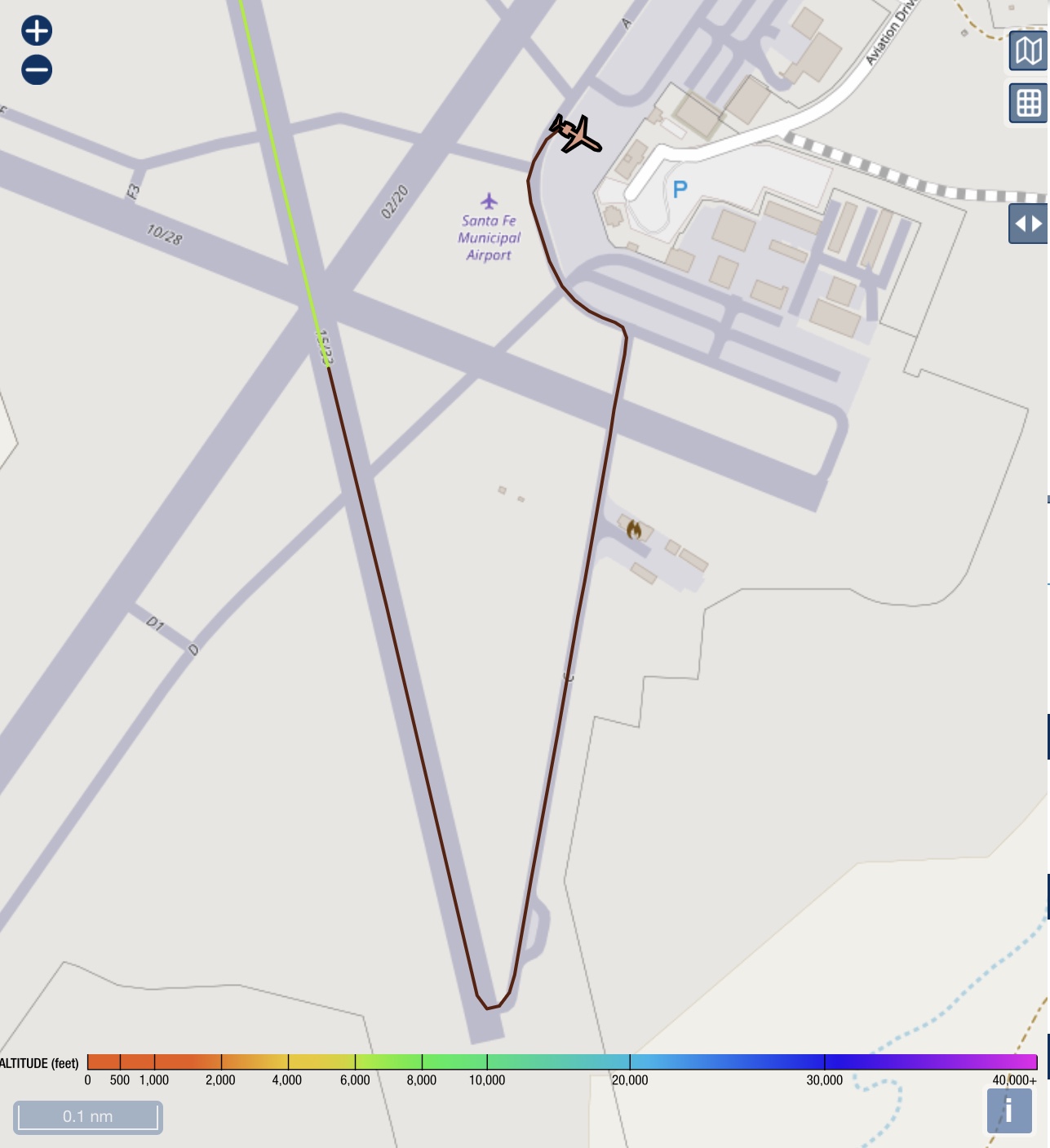
I opened up my PiAware page just to see if there was anything to grab and watched this SkyWest land, taxi, and shut down. The map accuracy is amazing and I’m not sure you can get this kind of detail on the actual FlightAware site. You may be able to but so far I haven’t seen it.
IIRC, some airports even have ground vehicles equipped but might be way off on that. My local airport doesn’t have that so I only see the aircraft.
This was the track from the plane that just landed.
How do you do that tho ??
Here are some instructions.
Yep - what Jon said.
Once you set up the Pi, PiAware software, the receiver, and antenna (there’s a little more to it but not much), you just point a browser on the local network at the Pi’s IP address and you get the map display with a listing of all the aircraft your setup can see. You can zoom in and out, pan, show tracks or not, etc.
Just be aware that you’ll only get that sort of level of detail if you’re close enough to an airport - The average receiver will not pick up that sort of ground activity.
Good point, @keithma. I’ve got a pretty clear shot from my antenna to the airport. When planes are between hangers and blocked by structures, it gets a little more dicey. I still have amazing coverage there though.
I’ve got a mountain between my antenna and KABQ and can’t watch ground ops there. Planes appear/disappear about 1000’ AGL or so.
But for those that are close to airports with unobstructed views, it’s pretty cool stuff.
This topic was automatically closed 30 days after the last reply. New replies are no longer allowed.