
I have had a few instances in the past week when I saw a SAR helicopter on AIS and ADS-B at the same time. The Swedish Coast Guard flies some Dash 8 aircraft that I regularly see on ADS-B, but they do not appear on my AIS feed so I assume they are not equipped with an AIS transponder.
A bit late to the party, just read this thread! I have just started playing with AIS and tried an Airspy Mini and AIS-catcher. I then tried RTL-SDR dongle: after calibration I could not tell the difference when compared with Mini, so reassigned Mini to better use. Before calibration the RTL dongle was not very good. Worth a try but calibrate first.
I live close to The Solent and Southampton Water on UK south coast. Vessel count weekdays 200-300 and 400 plus during summer weekends.
+1 I have an Airspy HF+ Discovery solely for HF and would not dedicate to AIS. But I did test it out on AIS and really could see no improvment over an RTL-SDR Blog v3 dongle with AIS-Catcher.
Hello, has anyone tried installing the AIS Dispatcher to be able to use the browser interface on the SARCNET image. Im just getting the below error. I even tried to build a completly new install using the raspi OS lite, installing rtl_ais using these instructions → rtl_ais and the AIS Dispatcher instructions → AIS Dispatcher
But I cannot for the life of me get it working.

Ha, although living far from the sea, I nevertheless “caught” two boats, a tour boat crusing on the local leisure lake and a maintance boat to to repairs on the river.
That’s about, I guess, there are a few rivers and canals used for transportation, but those will be to far away…

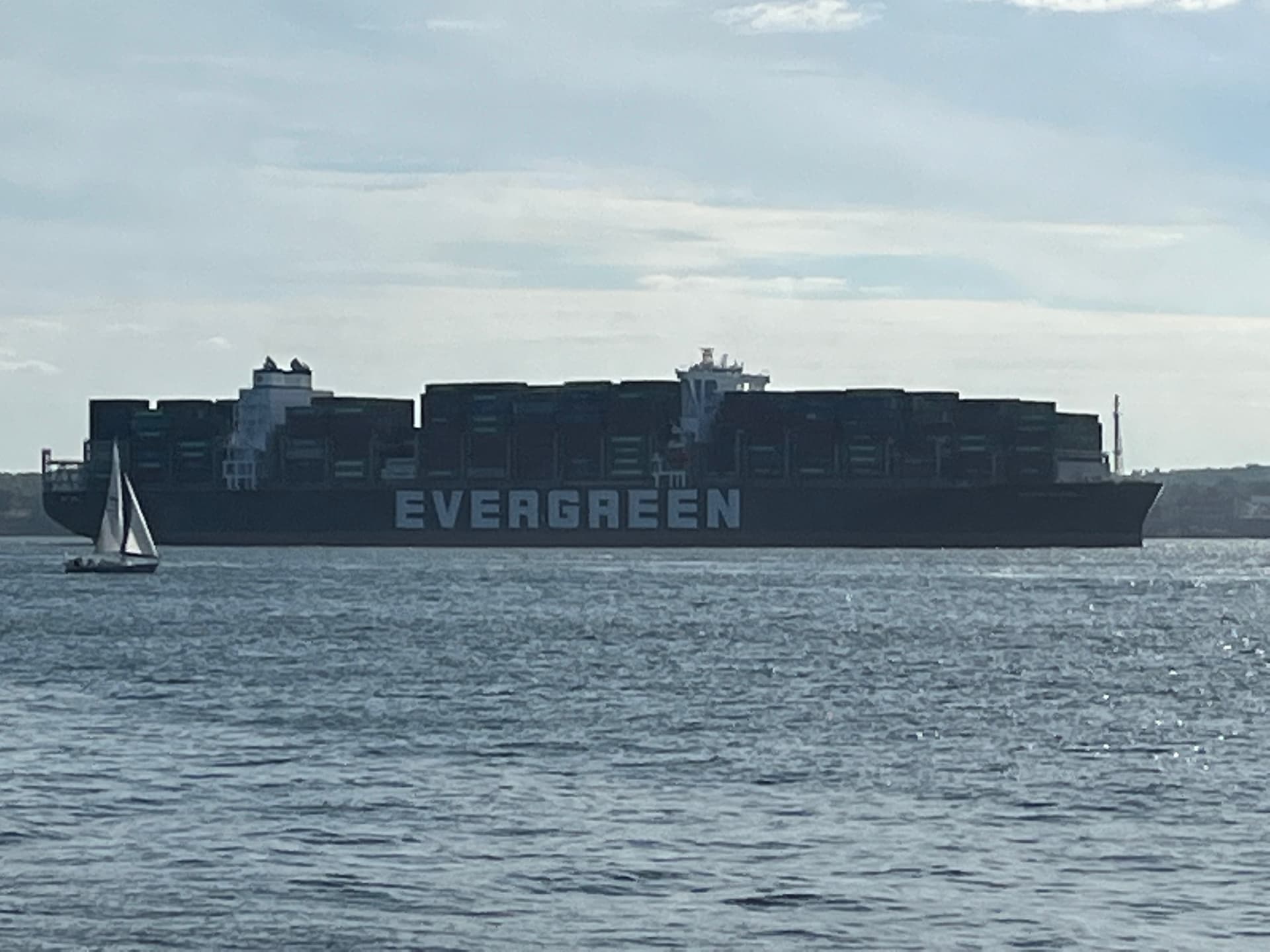
I caught this ship in the Hudson River a few weeks ago. It is the sister ship of an infamous ship that cause supply chain havoc last year.
1 Like
… or maybe not!
I literally build a 162MHz (more or less ![]() ) dipole antenna out of a coat hanger and increased the gain to 50.0, and look at that, several cargo vessel appear around 18 miles to the west. Not all that are out there, but nevertheless, I did not expect that.
) dipole antenna out of a coat hanger and increased the gain to 50.0, and look at that, several cargo vessel appear around 18 miles to the west. Not all that are out there, but nevertheless, I did not expect that.

3 Likes
Hi all,
For anyone with a FlightAware background, but new to AIS decoding, don’t overlook the FlightAware Orange receiver. Many here probably have a spare one. The internal pre-amp in the FA Orange does an excellent job on the 162 MHz AIS frequencies. It does NOT have a 1090 band-pass filter like the FA Blue, which would perform poorly assuming the filter is effective. No, I have never bothered to test an FA Blue on AIS!
I started with AIS over 15 years ago using discriminator tapped receivers and audio decoding. Then I switched to the RTL devices and have been through many different software packages with those.
My current favorite software is the AIS-decoder discussed here on both Linux and Windows.
My current best RTL receiver is the FA Orange. The RTL-SDR v3 is next, and I have also had good luck with cable tv pre-amps. I am currently running 5 x AIS decoder using 4 antennas. One of those is decoding Long Range message type 27 on 156.775 and 156.825 MHz.
Regards,
-Dan
2 Likes
I made a diy VERTICAL dipole from RG6 coax by seperating core and braid, and spresding in opposite directions, core acting as one arm of dipole, braid the other arm. It has 46 cm each arm (1/4 wavelength at 162 Mhz).
The dipole arms are held to window glass by adhessive tape. The length of coax from dipole to dvb-t is 3 meters, and dvb-t is plugged into PC running AIS-catcher software on Winfows-10. Gain setting 49. Got nothing, although Lake Ontatio is only 5 Kms, and I live in an aprtment in a high rise building, so antenna elevation above ground is good.
I changed generic dvb-t by FA Orange Prostick, still zero reception. I stopped AIS-catcher and fired SDRSharp, tuned it to 161.975 mhz, and observed for about an hour, no signal. Waterfall also shows nothing.
Has the AIS dipole to be Vertical (as is now) or Horizontal?


I would say vertical, as all the antennas I have seen on ships are all vertical. Have you thought about trying a flowerpot antenna? That’s what I managed to get the 4 vessels 19miles away in my previous screenshot further up the thread and that was without an amp.
OK, found the bug.
It was a silly mistake. I have set ppm correction to -34 instead of 34.

Once I removed the minus sign, I started receiving lot of messages
Contents of batch file AIS-Catcher-START-my-DVBT.bat after changing -p -34 to -p 34
AIS-catcher -v 10 -u 127.0.0.1 10110 -M DT -gr TUNER 49.6 RTLAGC off  -s 2304k -p 34 -o 4 >> C:\Users\abcd\Desktop\SHOTCUTS\AIS-Catcher-output.txt
PAUSE
Content of AIS-Catcher-output.txt:
{"class":"AIS","device":"AIS-catcher","rxtime":"20221009010121","scaled":true,"channel":"B","nmea":["!AIVDM,1,1,,B,34eHd6EPABrDUrBHv00l;kKp0P01,0*40"],"signalpower":-40.854187,"ppm":2.314815,"type":3,"repeat":0,"mmsi":316025881,"status":5,"status_text":"Moored","turn":"fastleft","speed":8.200000,"accuracy":true,"lon":-79.387611,"lat":43.636059,"course":107.099998,"heading":109,"second":60,"maneuver":0,"raim":false,"radio":131073}
{"class":"AIS","device":"AIS-catcher","rxtime":"20221009010122","scaled":true,"channel":"B","nmea":["!AIVDM,1,1,,B,14eIo7@P0crDaQrHv45rV?vd2H=0,0*22"],"signalpower":-43.866138,"ppm":0.289352,"type":1,"repeat":0,"mmsi":316045085,"status":0,"status_text":"Under way using engine","turn":"nan","speed":4.300000,"accuracy":true,"lon":-79.375259,"lat":43.637798,"course":271.200012,"heading":511,"second":22,"maneuver":0,"raim":true,"radio":99136}
{"class":"AIS","device":"AIS-catcher","rxtime":"20221009010123","scaled":true,"channel":"B","nmea":["!AIVDM,1,1,,B,14eJ57hP09rDbwJHuVaW=Ovf2<0N,0*1A"],"signalpower":-41.086624,"ppm":0.000000,"type":1,"repeat":0,"mmsi":316048671,"status":0,"status_text":"Under way using engine","turn":"nan","speed":0.900000,"accuracy":true,"lon":-79.370270,"lat":43.625237,"course":184.500000,"heading":511,"second":23,"maneuver":0,"raim":true,"radio":49182}
{"class":"AIS","device":"AIS-catcher","rxtime":"20221009010127","scaled":true,"channel":"B","nmea":["!AIVDM,1,1,,B,14eJ5MPP0WJDf<>Hv?IkaOvl0H?l,0*46"],"signalpower":-42.607876,"ppm":3.472222,"type":1,"repeat":0,"mmsi":316048758,"status":0,"status_text":"Under way using engine","turn":"nan","speed":3.900000,"accuracy":false,"lon":-79.359352,"lat":43.642624,"course":93.300003,"heading":511,"second":26,"maneuver":0,"raim":false,"radio":99316}
{"class":"AIS","device":"AIS-catcher","rxtime":"20221009010131","scaled":true,"channel":"A","nmea":["!AIVDM,1,1,,A,14eIo7@P0arDaMLHv43rBgvv20S@,0*3F"],"signalpower":-41.600109,"ppm":-0.578704,"type":1,"repeat":0,"mmsi":316045085,"status":0,"status_text":"Under way using engine","turn":"nan","speed":4.100000,"accuracy":true,"lon":-79.375496,"lat":43.637787,"course":263.399994,"heading":511,"second":31,"maneuver":0,"raim":true,"radio":2256}
{"class":"AIS","device":"AIS-catcher","rxtime":"20221009010133","scaled":true,"channel":"A","nmea":["!AIVDM,1,1,,A,14eJ57hP0;rDbwjHuVa1R?w22<0N,0*17"],"signalpower":-40.129204,"ppm":0.000000,"type":1,"repeat":0,"mmsi":316048671,"status":0,"status_text":"Under way using engine","turn":"nan","speed":1.100000,"accuracy":true,"lon":-79.370255,"lat":43.625233,"course":39.200001,"heading":511,"second":33,"maneuver":0,"raim":true,"radio":49182}
{"class":"AIS","device":"AIS-catcher","rxtime":"20221009010135","scaled":true,"channel":"A","nmea":["!AIVDM,1,1,,A,14eGckk001JDSkfHuvJ:9Wov0`DW,0*0C"],"signalpower":-42.180389,"ppm":4.340278,"type":1,"repeat":0,"mmsi":316009423,"status":3,"status_text":"Restricted manoeuverability","turn":0,"speed":0.100000,"accuracy":false,"lon":-79.394791,"lat":43.635372,"course":259.799988,"heading":251,"second":63,"maneuver":0,"raim":false,"radio":165159}
{"class":"AIS","device":"AIS-catcher","rxtime":"20221009010136","scaled":true,"channel":"B","nmea":["!AIVDM,1,1,,B,14eTmr8P00JDTiHHv1:f4?w80D0D,0*0A"],"signalpower":-46.007050,"ppm":0.578704,"type":1,"repeat":0,"mmsi":316225000,"status":8,"status_text":"Under way sailing","turn":"nan","speed":0.000000,"accuracy":false,"lon":-79.391502,"lat":43.636551,"course":360.000000,"heading":511,"second":36,"maneuver":0,"raim":false,"radio":81940}
{"class":"AIS","device":"AIS-catcher","rxtime":"20221009010142","scaled":true,"channel":"B","nmea":["!AIVDM,1,1,,B,14eIo7@P0`rDaH>Hv3uawOwD2D0F,0*27"],"signalpower":-40.287506,"ppm":-0.868056,"type":1,"repeat":0,"mmsi":316045085,"status":0,"status_text":"Under way using engine","turn":"nan","speed":4.000000,"accuracy":true,"lon":-79.375778,"lat":43.637745,"course":255.699997,"heading":511,"second":42,"maneuver":0,"raim":true,"radio":81942}
{"class":"AIS","device":"AIS-catcher","rxtime":"20221009010144","scaled":true,"channel":"B","nmea":["!AIVDM,1,1,,B,14eJ57hP0ErDc0`HuVk@fOwF28Ib,0*3C"],"signalpower":-41.699673,"ppm":0.578704,"type":1,"repeat":0,"mmsi":316048671,"status":0,"status_text":"Under way using engine","turn":"nan","speed":2.100000,"accuracy":true,"lon":-79.370209,"lat":43.625301,"course":18.500000,"heading":511,"second":43,"maneuver":0,"raim":true,"radio":34410}
{"class":"AIS","device":"AIS-catcher","rxtime":"20221009010145","scaled":true,"channel":"B","nmea":["!AIVDM,1,1,,B,14eGckk001JDSkbHuvIJ9Wov0PRg,0*6E"],"signalpower":-44.329433,"ppm":4.340278,"type":1,"repeat":0,"mmsi":316009423,"status":3,"status_text":"Restricted manoeuverability","turn":0,"speed":0.100000,"accuracy":false,"lon":-79.394791,"lat":43.635368,"course":259.799988,"heading":251,"second":63,"maneuver":0,"raim":false,"radio":133295}
{"class":"AIS","device":"AIS-catcher","rxtime":"20221009010146","scaled":true,"channel":"A","nmea":["!AIVDM,1,1,,A,14eJ4k0P00JD`FhHv7iN4?wL0@K6,0*60"],"signalpower":-43.761772,"ppm":0.578704,"type":1,"repeat":0,"mmsi":316048588,"status":0,"status_text":"Under way using engine","turn":"nan","speed":0.000000,"accuracy":false,"lon":-79.379265,"lat":43.639370,"course":360.000000,"heading":511,"second":46,"maneuver":0,"raim":false,"radio":67270}
{"class":"AIS","device":"AIS-catcher","rxtime":"20221009010146","scaled":true,"channel":"A","nmea":["!AIVDM,1,1,,A,14eI6D`P00rDSndHuqj>4?wL2484,0*00"],"signalpower":-42.653847,"ppm":2.314815,"type":1,"repeat":0,"mmsi":316032594,"status":8,"status_text":"Under way sailing","turn":"nan","speed":0.000000,"accuracy":true,"lon":-79.394630,"lat":43.633400,"course":360.000000,"heading":511,"second":46,"maneuver":0,"raim":true,"radio":16900}
{"class":"AIS","device":"AIS-catcher","rxtime":"20221009010151","scaled":true,"channel":"A","nmea":["!AIVDM,1,1,,A,14eIo7@P0`rDaD4Hv3maiOwV2@N2,0*38"],"signalpower":-38.759850,"ppm":-0.289352,"type":1,"repeat":0,"mmsi":316045085,"status":0,"status_text":"Under way using engine","turn":"nan","speed":4.000000,"accuracy":true,"lon":-79.375999,"lat":43.637691,"course":250.100006,"heading":511,"second":51,"maneuver":0,"raim":true,"radio":67458}
{"class":"AIS","device":"AIS-catcher","rxtime":"20221009010152","scaled":true,"channel":"A","nmea":["!AIVDM,1,1,,A,14eJ57hP0JrDc1DHuW1PTOw`2@NW,0*00"],"signalpower":-39.926472,"ppm":0.000000,"type":1,"repeat":0,"mmsi":316048671,"status":0,"status_text":"Under way using engine","turn":"nan","speed":2.600000,"accuracy":true,"lon":-79.370171,"lat":43.625397,"course":14.500000,"heading":511,"second":52,"maneuver":0,"raim":true,"radio":67495}
{"class":"AIS","device":"AIS-catcher","rxtime":"20221009010152","scaled":true,"channel":"A","nmea":["!AIVDM,1,1,,A,14eHd6E01KrDVJ@HuwLSw3Cp0l0O,0*38"],"signalpower":-39.872326,"ppm":1.446759,"type":1,"repeat":0,"mmsi":316025881,"status":5,"status_text":"Moored","turn":0,"speed":9.100000,"accuracy":true,"lon":-79.385910,"lat":43.635818,"course":102.000000,"heading":105,"second":60,"maneuver":0,"raim":false,"radio":213023}
{"class":"AIS","device":"AIS-catcher","rxtime":"20221009010154","scaled":true,"channel":"A","nmea":["!AIVDM,1,1,,A,14eGckk001JDSkVHuvI:9Wov0PSL,0*03"],"signalpower":-42.356445,"ppm":4.340278,"type":1,"repeat":0,"mmsi":316009423,"status":3,"status_text":"Restricted manoeuverability","turn":0,"speed":0.100000,"accuracy":false,"lon":-79.394798,"lat":43.635368,"course":259.799988,"heading":251,"second":63,"maneuver":0,"raim":false,"radio":133340}
{"class":"AIS","device":"AIS-catcher","rxtime":"20221009010201","scaled":true,"channel":"B","nmea":["!AIVDM,1,1,,B,14eHd6E01MrDVSnHuwA3wSCp0l0P,0*18"],"signalpower":-37.526859,"ppm":0.868056,"type":1,"repeat":0,"mmsi":316025881,"status":5,"status_text":"Moored","turn":0,"speed":9.300000,"accuracy":true,"lon":-79.385391,"lat":43.635738,"course":102.199997,"heading":105,"second":60,"maneuver":0,"raim":false,"radio":213024}
{"class":"AIS","device":"AIS-catcher","rxtime":"20221009010201","scaled":true,"channel":"B","nmea":["!AIVDM,1,1,,B,14eIo7@P0arDa?RHv3baW?v22<0F,0*75"],"signalpower":-39.056099,"ppm":-0.868056,"type":1,"repeat":0,"mmsi":316045085,"status":0,"status_text":"Under way using engine","turn":"nan","speed":4.100000,"accuracy":true,"lon":-79.376236,"lat":43.637615,"course":246.000000,"heading":511,"second":1,"maneuver":0,"raim":true,"radio":49174}
{"class":"AIS","device":"AIS-catcher","rxtime":"20221009010204","scaled":true,"channel":"B","nmea":["!AIVDM,1,1,,B,14eJ57hP0NrDc2>HuWG@POv62@2A,0*21"],"signalpower":-37.954887,"ppm":-0.289352,"type":1,"repeat":0,"mmsi":316048671,"status":0,"status_text":"Under way using engine","turn":"nan","speed":3.000000,"accuracy":true,"lon":-79.370125,"lat":43.625542,"course":12.900000,"heading":511,"second":3,"maneuver":0,"raim":true,"radio":65681}
{"class":"AIS","device":"AIS-catcher","rxtime":"20221009010205","scaled":true,"channel":"B","nmea":["!AIVDM,1,1,,B,14eGckk001JDSkbHuvIJ9Wov0`2w,0*2E"],"signalpower":-44.893036,"ppm":4.050926,"type":1,"repeat":0,"mmsi":316009423,"status":3,"status_text":"Restricted manoeuverability","turn":0,"speed":0.100000,"accuracy":false,"lon":-79.394791,"lat":43.635368,"course":259.799988,"heading":251,"second":63,"maneuver":0,"raim":false,"radio":164031}
{"class":"AIS","device":"AIS-catcher","rxtime":"20221009010205","scaled":true,"channel":"A","nmea":["!AIVDM,1,1,,A,14eJ4k0P00JD`E2Hv7av4?v:0@3@,0*70"],"signalpower":-43.447853,"ppm":-0.289352,"type":1,"repeat":0,"mmsi":316048588,"status":0,"status_text":"Under way using engine","turn":"nan","speed":0.000000,"accuracy":false,"lon":-79.379356,"lat":43.639317,"course":360.000000,"heading":511,"second":5,"maneuver":0,"raim":false,"radio":65744}
{"class":"AIS","device":"AIS-catcher","rxtime":"20221009010206","scaled":true,"channel":"A","nmea":["!AIVDM,1,1,,A,14eI6D`P00rDSnTHuqhf4?v<20S@,0*00"],"signalpower":-43.176746,"ppm":2.314815,"type":1,"repeat":0,"mmsi":316032594,"status":8,"status_text":"Under way sailing","turn":"nan","speed":0.000000,"accuracy":true,"lon":-79.394638,"lat":43.633389,"course":360.000000,"heading":511,"second":6,"maneuver":0,"raim":true,"radio":2256}
{"class":"AIS","device":"AIS-catcher","rxtime":"20221009010211","scaled":true,"channel":"A","nmea":["!AIVDM,1,1,,A,14eHd6EOiLrDVfPHuw4kuSEp0l0Q,0*1E"],"signalpower":-39.809174,"ppm":1.446759,"type":1,"repeat":0,"mmsi":316025881,"status":5,"status_text":"Moored","turn":"fastright","speed":9.200000,"accuracy":true,"lon":-79.384827,"lat":43.635658,"course":101.400002,"heading":106,"second":60,"maneuver":0,"raim":false,"radio":213025}
{"class":"AIS","device":"AIS-catcher","rxtime":"20221009010214","scaled":true,"channel":"A","nmea":["!AIVDM,1,1,,A,14eGckk001JDSktHuvGb9Wov0PT5,0*09"],"signalpower":-42.285355,"ppm":3.761574,"type":1,"repeat":0,"mmsi":316009423,"status":3,"status_text":"Restricted manoeuverability","turn":0,"speed":0.100000,"accuracy":false,"lon":-79.394775,"lat":43.635357,"course":259.799988,"heading":251,"second":63,"maneuver":0,"raim":false,"radio":133381}
{"class":"AIS","device":"AIS-catcher","rxtime":"20221009010227","scaled":true,"channel":"A","nmea":["!AIVDM,1,1,,A,14eJ4k0P00JD`CjHv7Uf4?vn0H?q,0*6B"],"signalpower":-43.510475,"ppm":-0.289352,"type":1,"repeat":0,"mmsi":316048588,"status":0,"status_text":"Under way using engine","turn":"nan","speed":0.000000,"accuracy":false,"lon":-79.379425,"lat":43.639290,"course":360.000000,"heading":511,"second":27,"maneuver":0,"raim":false,"radio":99321}
{"class":"AIS","device":"AIS-catcher","rxtime":"20221009010227","scaled":true,"channel":"A","nmea":["!AIVDM,1,1,,A,14eI6D`P00rDSnTHuqiN4?vn2488,0*6C"],"signalpower":-42.753124,"ppm":2.025463,"type":1,"repeat":0,"mmsi":316032594,"status":8,"status_text":"Under way sailing","turn":"nan","speed":0.000000,"accuracy":true,"lon":-79.394638,"lat":43.633396,"course":360.000000,"heading":511,"second":27,"maneuver":0,"raim":true,"radio":16904}
{"class":"AIS","device":"AIS-catcher","rxtime":"20221009010231","scaled":true,"channel":"A","nmea":["!AIVDM,1,1,,A,14eIo7@P0brDa1RHv3?J2wvv2HBV,0*72"],"signalpower":-42.834240,"ppm":-0.578704,"type":1,"repeat":0,"mmsi":316045085,"status":0,"status_text":"Under way using engine","turn":"nan","speed":4.200000,"accuracy":true,"lon":-79.376984,"lat":43.637436,"course":257.100006,"heading":511,"second":31,"maneuver":0,"raim":true,"radio":99494}
{"class":"AIS","device":"AIS-catcher","rxtime":"20221009010233","scaled":true,"channel":"A","nmea":["!AIVDM,1,1,,A,14eJ57hP09rDc2pHu`3C<gw228CQ,0*03"],"signalpower":-45.241756,"ppm":-0.289352,"type":1,"repeat":0,"mmsi":316048671,"status":0,"status_text":"Under way using engine","turn":"nan","speed":0.900000,"accuracy":true,"lon":-79.370087,"lat":43.625835,"course":81.800003,"heading":511,"second":33,"maneuver":0,"raim":true,"radio":34017}
{"class":"AIS","device":"AIS-catcher","rxtime":"20221009010235","scaled":true,"channel":"A","nmea":["!AIVDM,1,1,,A,14eGckk001JDSlPHuvE:9Wov0W3h,0*4D"],"signalpower":-42.146034,"ppm":4.050926,"type":1,"repeat":0,"mmsi":316009423,"status":3,"status_text":"Restricted manoeuverability","turn":0,"speed":0.100000,"accuracy":false,"lon":-79.394745,"lat":43.635342,"course":259.799988,"heading":251,"second":63,"maneuver":0,"raim":false,"radio":159984}
{"class":"AIS","device":"AIS-catcher","rxtime":"20221009010241","scaled":true,"channel":"B","nmea":["!AIVDM,1,1,,B,14eHd6EOiGrDW<FHuv64gSup0`Gw,0*78"],"signalpower":-45.707874,"ppm":1.157407,"type":1,"repeat":0,"mmsi":316025881,"status":5,"status_text":"Moored","turn":"fastright","speed":8.700000,"accuracy":true,"lon":-79.383232,"lat":43.635239,"course":121.400002,"heading":126,"second":60,"maneuver":0,"raim":false,"radio":165375}
{"class":"AIS","device":"AIS-catcher","rxtime":"20221009010246","scaled":true,"channel":"A","nmea":["!AIVDM,1,1,,A,14eI6D`P00rDSnRHuqh>4?wL20Rq,0*1F"],"signalpower":-42.576008,"ppm":2.604167,"type":1,"repeat":0,"mmsi":316032594,"status":8,"status_text":"Under way sailing","turn":"nan","speed":0.000000,"accuracy":true,"lon":-79.394638,"lat":43.633389,"course":360.000000,"heading":511,"second":46,"maneuver":0,"raim":true,"radio":2233}
{"class":"AIS","device":"AIS-catcher","rxtime":"20221009010252","scaled":true,"channel":"B","nmea":["!AIVDM,1,1,,B,14eGHph000rDhPNHv7NTm1qT0488,0*4C"],"signalpower":-45.564278,"ppm":2.893518,"type":1,"repeat":0,"mmsi":316004579,"status":0,"status_text":"Under way using engine","turn":0,"speed":0.000000,"accuracy":true,"lon":-79.351440,"lat":43.639244,"course":123.599998,"heading":60,"second":50,"maneuver":0,"raim":false,"radio":16904}
{"class":"AIS","device":"AIS-catcher","rxtime":"20221009010252","scaled":true,"channel":"A","nmea":["!AIVDM,1,1,,A,14eJ57hP0krDc9BHu`2ju?w`2<0N,0*6B"],"signalpower":-41.572613,"ppm":-0.289352,"type":1,"repeat":0,"mmsi":316048671,"status":0,"status_text":"Under way using engine","turn":"nan","speed":5.100000,"accuracy":true,"lon":-79.369743,"lat":43.625832,"course":75.599998,"heading":511,"second":52,"maneuver":0,"raim":true,"radio":49182}
{"class":"AIS","device":"AIS-catcher","rxtime":"20221009010252","scaled":true,"channel":"A","nmea":["!AIVDM,1,1,,A,14eHd6EOiIrDWEjHuuQlwD;p0hNj,0*49"],"signalpower":-43.384949,"ppm":1.736111,"type":1,"repeat":0,"mmsi":316025881,"status":5,"status_text":"Moored","turn":"fastright","speed":8.900000,"accuracy":true,"lon":-79.382729,"lat":43.634998,"course":127.699997,"heading":133,"second":60,"maneuver":0,"raim":false,"radio":198578}
{"class":"AIS","device":"AIS-catcher","rxtime":"20221009010255","scaled":true,"channel":"A","nmea":["!AIVDM,1,1,,A,14eGckk001JDSllHuvEJ9Wqv0hP9,0*12"],"signalpower":-42.452946,"ppm":4.050926,"type":1,"repeat":0,"mmsi":316009423,"status":3,"status_text":"Restricted manoeuverability","turn":0,"speed":0.100000,"accuracy":false,"lon":-79.394730,"lat":43.635342,"course":259.799988,"heading":252,"second":63,"maneuver":0,"raim":false,"radio":198665}
{"class":"AIS","device":"AIS-catcher","rxtime":"20221009010256","scaled":true,"channel":"B","nmea":["!AIVDM,1,1,,B,14eTmr8P00JDTiHHv18>4?wf00SW,0*0A"],"signalpower":-45.413952,"ppm":0.289352,"type":1,"repeat":0,"mmsi":316225000,"status":8,"status_text":"Under way sailing","turn":"nan","speed":0.000000,"accuracy":false,"lon":-79.391502,"lat":43.636532,"course":360.000000,"heading":511,"second":55,"maneuver":0,"raim":false,"radio":2279}
{"class":"AIS","device":"AIS-catcher","rxtime":"20221009010301","scaled":true,"channel":"B","nmea":["!AIVDM,1,1,,B,14eIo7@P0crD`jVHv30J;?v2280e,0*15"],"signalpower":-39.504688,"ppm":-1.157407,"type":1,"repeat":0,"mmsi":316045085,"status":0,"status_text":"Under way using engine","turn":"nan","speed":4.300000,"accuracy":true,"lon":-79.377785,"lat":43.637337,"course":260.399994,"heading":511,"second":1,"maneuver":0,"raim":true,"radio":32813}
{"class":"AIS","device":"AIS-catcher","rxtime":"20221009010304","scaled":true,"channel":"B","nmea":["!AIVDM,1,1,,B,34eJ57hP1<rDcA6Hu`HB=?v624pk,0*10"],"signalpower":-43.751671,"ppm":-0.289352,"type":3,"repeat":0,"mmsi":316048671,"status":0,"status_text":"Under way using engine","turn":"nan","speed":7.600000,"accuracy":true,"lon":-79.369331,"lat":43.625977,"course":56.400002,"heading":511,"second":3,"maneuver":0,"raim":true,"radio":20019}
{"class":"AIS","device":"AIS-catcher","rxtime":"20221009010305","scaled":true,"channel":"B","nmea":["!AIVDM,2,1,4,B,54eHd6H00001H7CSCJ1Lnr0iTtr0l4<dDq`TF20k10A4240Ht653lSkU,0*48","!AIVDM,2,2,4,B,3p8888888888880,2*60"],"signalpower":-39.606434,"ppm":1.157407,"type":5,"repeat":0,"mmsi":316025881,"ais_version":2,"imo":0,"callsign":"VA4846","shipname":"WM. LYON MACKENZIE","shiptype":51,"shiptype_text":"Search and Rescue vessel","to_bow":8,"to_stern":17,"to_port":4,"to_starboard":2,"epfd":1,"epfd_text":"GPS","eta":"00-00T24:60Z","hour":24,"minute":60,"draught":2.400000,"destination":"TORONTO","dte":false}
{"class":"AIS","device":"AIS-catcher","rxtime":"20221009010307","scaled":true,"channel":"A","nmea":["!AIVDM,1,1,,A,14eI6D`P00rDSnbHuqh>4?v<2D0A,0*78"],"signalpower":-42.973724,"ppm":2.025463,"type":1,"repeat":0,"mmsi":316032594,"status":8,"status_text":"Under way sailing","turn":"nan","speed":0.000000,"accuracy":true,"lon":-79.394630,"lat":43.633389,"course":360.000000,"heading":511,"second":6,"maneuver":0,"raim":true,"radio":81937}
{"class":"AIS","device":"AIS-catcher","rxtime":"20221009010311","scaled":true,"channel":"A","nmea":["!AIVDM,1,1,,A,14eHd6EOiIrDWUnHutF59lAp0h6g,0*7B"],"signalpower":-43.567867,"ppm":1.157407,"type":1,"repeat":0,"mmsi":316025881,"status":5,"status_text":"Moored","turn":"fastright","speed":8.900000,"accuracy":true,"lon":-79.381874,"lat":43.634495,"course":131.899994,"heading":136,"second":60,"maneuver":0,"raim":false,"radio":197039}
{"class":"AIS","device":"AIS-catcher","rxtime":"20221009010312","scaled":true,"channel":"A","nmea":["!AIVDM,1,1,,A,14eJ57hP1BrDcG`Hu`pQlgvH2D0N,0*76"],"signalpower":-41.063026,"ppm":-0.289352,"type":1,"repeat":0,"mmsi":316048671,"status":0,"status_text":"Under way using engine","turn":"nan","speed":8.200000,"accuracy":true,"lon":-79.368980,"lat":43.626190,"course":46.599998,"heading":511,"second":12,"maneuver":0,"raim":true,"radio":81950}
{"class":"AIS","device":"AIS-catcher","rxtime":"20221009010313","scaled":true,"channel":"A","nmea":["!AIVDM,1,1,,A,14eIo7@P0crD`e0Hv2rr:wvH248<,0*6A"],"signalpower":-39.499077,"ppm":-1.157407,"type":1,"repeat":0,"mmsi":316045085,"status":0,"status_text":"Under way using engine","turn":"nan","speed":4.300000,"accuracy":true,"lon":-79.378082,"lat":43.637299,"course":260.299988,"heading":511,"second":12,"maneuver":0,"raim":true,"radio":16908}
{"class":"AIS","device":"AIS-catcher","rxtime":"20221009010315","scaled":true,"channel":"A","nmea":["!AIVDM,1,1,,A,14eGckk001JDSldHuvIJ9Wov0d0L,0*11"],"signalpower":-41.843723,"ppm":4.050926,"type":1,"repeat":0,"mmsi":316009423,"status":3,"status_text":"Restricted manoeuverability","turn":0,"speed":0.100000,"accuracy":false,"lon":-79.394737,"lat":43.635368,"course":259.799988,"heading":251,"second":63,"maneuver":0,"raim":false,"radio":180252}
{"class":"AIS","device":"AIS-catcher","rxtime":"20221009010323","scaled":true,"channel":"B","nmea":["!AIVDM,1,1,,B,14eJ57hP1HrDcNvHuaaiMwvf248<,0*5D"],"signalpower":-41.887566,"ppm":0.000000,"type":1,"repeat":0,"mmsi":316048671,"status":0,"status_text":"Under way using engine","turn":"nan","speed":8.800000,"accuracy":true,"lon":-79.368591,"lat":43.626518,"course":37.500000,"heading":511,"second":23,"maneuver":0,"raim":true,"radio":16908}
{"class":"AIS","device":"AIS-catcher","rxtime":"20221009010324","scaled":true,"channel":"B","nmea":["!AIVDM,1,1,,B,14eGckk001JDSm6HuvHJ9Wov0d0L,0*40"],"signalpower":-43.708046,"ppm":4.050926,"type":1,"repeat":0,"mmsi":316009423,"status":3,"status_text":"Restricted manoeuverability","turn":0,"speed":0.100000,"accuracy":false,"lon":-79.394714,"lat":43.635361,"course":259.799988,"heading":251,"second":63,"maneuver":0,"raim":false,"radio":180252}
{"class":"AIS","device":"AIS-catcher","rxtime":"20221009010327","scaled":true,"channel":"A","nmea":["!AIVDM,1,1,,A,14eJ4k0P00JD`C6Hv7KN4?vn0D0C,0*30"],"signalpower":-44.170815,"ppm":-0.578704,"type":1,"repeat":0,"mmsi":316048588,"status":0,"status_text":"Under way using engine","turn":"nan","speed":0.000000,"accuracy":false,"lon":-79.379463,"lat":43.639221,"course":360.000000,"heading":511,"second":27,"maneuver":0,"raim":false,"radio":81939}
{"class":"AIS","device":"AIS-catcher","rxtime":"20221009010327","scaled":true,"channel":"A","nmea":["!AIVDM,1,1,,A,14eI6D`P01rDSo2Huqk@3Ovn20Ri,0*4E"],"signalpower":-42.837963,"ppm":0.578704,"type":1,"repeat":0,"mmsi":316032594,"status":8,"status_text":"Under way sailing","turn":"nan","speed":0.100000,"accuracy":true,"lon":-79.394615,"lat":43.633408,"course":1.300000,"heading":511,"second":27,"maneuver":0,"raim":true,"radio":2225}
{"class":"AIS","device":"AIS-catcher","rxtime":"20221009010329","scaled":true,"channel":"A","nmea":["!AIVDM,1,1,,A,34eJ6nUP00rDhWjHv:uN4?vr2DWb,0*43"],"signalpower":-43.596748,"ppm":-0.578704,"type":3,"repeat":0,"mmsi":316049114,"status":5,"status_text":"Moored","turn":"nan","speed":0.000000,"accuracy":true,"lon":-79.351051,"lat":43.640728,"course":360.000000,"heading":511,"second":29,"maneuver":0,"raim":true,"radio":84458}
{"class":"AIS","device":"AIS-catcher","rxtime":"20221009010331","scaled":true,"channel":"A","nmea":["!AIVDM,1,1,,A,14eIo7@P0drD`SFHv2g:3wvv2D0F,0*45"],"signalpower":-39.477478,"ppm":-0.868056,"type":1,"repeat":0,"mmsi":316045085,"status":0,"status_text":"Under way using engine","turn":"nan","speed":4.400000,"accuracy":true,"lon":-79.378593,"lat":43.637218,"course":257.500000,"heading":511,"second":31,"maneuver":0,"raim":true,"radio":81942}
{"class":"AIS","device":"AIS-catcher","rxtime":"20221009010333","scaled":true,"channel":"A","nmea":["!AIVDM,1,1,,A,14eJ57hP1JrDcU>HubL1G?w2248<,0*6E"],"signalpower":-43.424229,"ppm":-0.289352,"type":1,"repeat":0,"mmsi":316048671,"status":0,"status_text":"Under way using engine","turn":"nan","speed":9.000000,"accuracy":true,"lon":-79.368256,"lat":43.626854,"course":34.799999,"heading":511,"second":33,"maneuver":0,"raim":true,"radio":16908}
{"class":"AIS","device":"AIS-catcher","rxtime":"20221009010334","scaled":true,"channel":"B","nmea":["!AIVDM,2,1,5,B,54eJ6n`000000000000nqJr18UHE:0L4l8hE80151HD3:t0Ht3m3lSkU,0*54","!AIVDM,2,2,5,B,3p20DPSlP000000,2*28"],"signalpower":-42.906803,"ppm":-0.578704,"type":5,"repeat":0,"mmsi":316049114,"ais_version":2,"imo":0,"callsign":"","shipname":"M.V. RIVER GAMBLER","shiptype":69,"shiptype_text":"Passenger, No additional information","to_bow":11,"to_stern":20,"to_port":3,"to_starboard":10,"epfd":15,"epfd_text":"Undefined","eta":"00-00T24:60Z","hour":24,"minute":60,"draught":1.500000,"destination":"TORONTO HARBOR","dte":false}
{"class":"AIS","device":"AIS-catcher","rxtime":"20221009010335","scaled":true,"channel":"A","nmea":["!AIVDM,1,1,,A,14eGckk001JDSm8HuvGb9Wov0PS6,0*47"],"signalpower":-41.769863,"ppm":4.050926,"type":1,"repeat":0,"mmsi":316009423,"status":3,"status_text":"Restricted manoeuverability","turn":0,"speed":0.100000,"accuracy":false,"lon":-79.394714,"lat":43.635357,"course":259.799988,"heading":251,"second":63,"maneuver":0,"raim":false,"radio":133318}
{"class":"AIS","device":"AIS-catcher","rxtime":"20221009010335","scaled":true,"channel":"B","nmea":["!AIVDM,1,1,,B,84eJ6nPj2d<<<<<<<0VHthOP4OL0,0*24"],"signalpower":-42.675446,"ppm":1.157407,"type":8,"repeat":0,"mmsi":316049114,"dac":200,"fid":10,"vin":"00000000","length":307,"beam":121,"shiptype":8444,"hazard":0,"draught":143,"loaded":2,"speed_q":true,"course_q":true,"heading_q":true}
{"class":"AIS","device":"AIS-catcher","rxtime":"20221009010337","scaled":true,"channel":"B","nmea":["!AIVDM,2,1,6,B,54eJ57p00000<H7GSG8PT5L5@P4000000000000t1pj31t0000000000,0*11","!AIVDM,2,2,6,B,000000000000000,2*21"],"signalpower":-43.252121,"ppm":-0.578704,"type":5,"repeat":0,"mmsi":316048671,"ais_version":2,"imo":0,"callsign":"CFA5852","shipname":"HIAWATHA","shiptype":60,"shiptype_text":"Passenger, all ships of this type","to_bow":15,"to_stern":50,"to_port":3,"to_starboard":1,"epfd":15,"epfd_text":"Undefined","eta":"00-00T00:00Z","draught":0.000000,"destination":"","dte":false}
{"class":"AIS","device":"AIS-catcher","rxtime":"20221009010338","scaled":true,"channel":"B","nmea":["!AIVDM,1,1,,B,14eI6D`P01rDSnPHuqh@3?w:2L0A,0*3E"],"signalpower":-46.353245,"ppm":2.025463,"type":1,"repeat":0,"mmsi":316032594,"status":8,"status_text":"Under way sailing","turn":"nan","speed":0.100000,"accuracy":true,"lon":-79.394638,"lat":43.633389,"course":1.200000,"heading":511,"second":37,"maneuver":0,"raim":true,"radio":114705}
{"class":"AIS","device":"AIS-catcher","rxtime":"20221009010341","scaled":true,"channel":"B","nmea":["!AIVDM,1,1,,B,14eHd6E01JrDWtvHurE5DTIp0T8<,0*44"],"signalpower":-42.171246,"ppm":1.157407,"type":1,"repeat":0,"mmsi":316025881,"status":5,"status_text":"Moored","turn":0,"speed":9.000000,"accuracy":true,"lon":-79.380638,"lat":43.633633,"course":136.199997,"heading":140,"second":60,"maneuver":0,"raim":false,"radio":147980}
{"class":"AIS","device":"AIS-catcher","rxtime":"20221009010342","scaled":true,"channel":"B","nmea":["!AIVDM,1,1,,B,14eIo7@P0drD`MdHv2WJ2?wD2<0F,0*38"],"signalpower":-36.308842,"ppm":-1.157407,"type":1,"repeat":0,"mmsi":316045085,"status":0,"status_text":"Under way using engine","turn":"nan","speed":4.400000,"accuracy":true,"lon":-79.378899,"lat":43.637169,"course":256.799988,"heading":511,"second":42,"maneuver":0,"raim":true,"radio":49174}
{"class":"AIS","device":"AIS-catcher","rxtime":"20221009010343","scaled":true,"channel":"B","nmea":["!AIVDM,1,1,,B,14eJ57hP1JrDcc@Huc?iDOwF20R<,0*66"],"signalpower":-44.497597,"ppm":0.000000,"type":1,"repeat":0,"mmsi":316048671,"status":0,"status_text":"Under way using engine","turn":"nan","speed":9.000000,"accuracy":true,"lon":-79.367935,"lat":43.627197,"course":33.700001,"heading":511,"second":43,"maneuver":0,"raim":true,"radio":2188}
{"class":"AIS","device":"AIS-catcher","rxtime":"20221009010346","scaled":true,"channel":"A","nmea":["!AIVDM,1,1,,A,14eI6D`P00rDSnlHuqjf4?wL2<0A,0*25"],"signalpower":-42.900578,"ppm":2.025463,"type":1,"repeat":0,"mmsi":316032594,"status":8,"status_text":"Under way sailing","turn":"nan","speed":0.000000,"accuracy":true,"lon":-79.394623,"lat":43.633404,"course":360.000000,"heading":511,"second":46,"maneuver":0,"raim":true,"radio":49169}
{"class":"AIS","device":"AIS-catcher","rxtime":"20221009010351","scaled":true,"channel":"A","nmea":["!AIVDM,1,1,,A,14eIo7@P0drD`I6Hv2QJ4wwV28N2,0*39"],"signalpower":-36.958817,"ppm":-1.446759,"type":1,"repeat":0,"mmsi":316045085,"status":0,"status_text":"Under way using engine","turn":"nan","speed":4.400000,"accuracy":true,"lon":-79.379143,"lat":43.637127,"course":257.899994,"heading":511,"second":51,"maneuver":0,"raim":true,"radio":34690}
{"class":"AIS","device":"AIS-catcher","rxtime":"20221009010352","scaled":true,"channel":"A","nmea":["!AIVDM,1,1,,A,14eJ57hP1KrDchhHucvABgw`28NW,0*51"],"signalpower":-42.491875,"ppm":-0.289352,"type":1,"repeat":0,"mmsi":316048671,"status":0,"status_text":"Under way using engine","turn":"nan","speed":9.100000,"accuracy":true,"lon":-79.367638,"lat":43.627510,"course":33.000000,"heading":511,"second":52,"maneuver":0,"raim":true,"radio":34727}
{"class":"AIS","device":"AIS-catcher","rxtime":"20221009010355","scaled":true,"channel":"A","nmea":["!AIVDM,1,1,,A,14eGckk001JDSllHuvFr9Wqv0d0L,0*30"],"signalpower":-41.834965,"ppm":4.050926,"type":1,"repeat":0,"mmsi":316009423,"status":3,"status_text":"Restricted manoeuverability","turn":0,"speed":0.100000,"accuracy":false,"lon":-79.394730,"lat":43.635353,"course":259.799988,"heading":252,"second":63,"maneuver":0,"raim":false,"radio":180252}
{"class":"AIS","device":"AIS-catcher","rxtime":"20221009010401","scaled":true,"channel":"B","nmea":["!AIVDM,1,1,,B,14eHd6EPAJrD`;tHupsm<TCp0d0R,0*66"],"signalpower":-41.850838,"ppm":1.736111,"type":1,"repeat":0,"mmsi":316025881,"status":5,"status_text":"Moored","turn":"fastleft","speed":9.000000,"accuracy":true,"lon":-79.379845,"lat":43.633038,"course":133.000000,"heading":137,"second":60,"maneuver":0,"raim":false,"radio":180258}
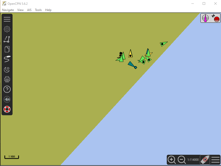
Windows Command Prompt

OpenCPN
2 Likes
This is what I see in SDR#

The signals for both AIS channels are clearly visible. You can adjust the RF gain in real time to improve the signal to noise and make them more visible.
It is also an easy way to visualize the frequency offset once you have calibrated the receiver. (I use a local trunking radio service site I know that is GPS locked to the correct frequency to get the actual PPM)

The ships at the north end of Port Phillip Bay are about 12 km and the channel marks at the South end are about 60km away. I use a dipole mounted outside but without line of site to the water.
You should be seeing much further than me.
S.

You seem to have a problem.
You should see the same whatever the offset. You are looking at a segment of spectrum and the PPM setting just slides the scale along the x axis. It will of course move the signal right out of the bandpass of the FM channel you are listening to for AIS.
Can you listen to that strong signal at 162.050 and identify it?Whatever it is it seems to be related to all the traces you can see in the waterfall. Also try sliding the gain control down and see if that clears it up.
Is it still there if you disconnect the antenna?
S.
1 Like
The strong signal, which is very close to 161.975 MHz is voice transmission (weather)
With Antenna Connected

With Antenna Dis-connected

Public Service Announcement: Having a setup all indoors, one should not underestimate the ability of locally produced QRM to reallly set back your reception. Here are two examples that affected me in the past 10 days.
-
Bad/Cheap/Incorrect type of LED bulb on a dimmer switch. The mother of all RFI. My AIS setup is in an upstairs room. When turning on a light downstairs my reception was absolutely obliterated. I assume the switch, light socket and thin client upstairs are on the same wiring loop. Although the LED bulb dimmed as expected, its provenance was dubious. I replaced it with a legit dimmable LED and the problem substantially went away. I’m suspicious that the dimmer switch in and of itself still causes some low level noise.
-
Ethernet cables. This example helped me realize I was not hallucinating. Again downstairs, we have a pair of small wifi extenders to sling the IPTV signal to a set top box/TV in another room. When moving some furniture I had to disconnect the extender to the TV. By chance I noticed my AIS message rate increased dramatically - like 100%. After a couple of power on/off of the extenders to confirm this had an effect I realized that simply powering them up and establishing a 5 Ghz link between them was not a problem. It was only when ethernet cables were plugged into the extenders that the fun began. The usefulness of the TV and its location were already under debate and I solved two problems by just shutting the whole lot off. As a test I did try a few ferrite beads that were laying around on the ethernet cables, but the result was zilch. A properly spec’d toroid as noted in the example would appear to be required.
1 Like
What does it look like if you reduce the gain say 20db on the sliding scale?
I can’t find a definitive and up-to-date Canadian VHF Maritime frequencies but there doesn’t appear to be a continuous transmitter around 162.0MHz. so it is probably overload from continuous broadcast on 161.65, 161.75, 161.85 or 161.2 based on this document.
S.
I’ve been feeding to Marine Traffic for a while now. I took the easy way and am using a receiver + antenna they provided. Reception is pretty great, super high range due to ducting just like my ADS-B receiver:
Reading this thread, I might have to try it out with my Airspy mini one day.
2 Likes
Dongle Used = Generic DVB-T (Black)
AIS-Catcher Settings:
Dongle gain set to max (49.6) : Message rate 0.3 ~ 0.4 msg/sec

AIS-Catcher Settings:
Dongle gain reduced to 25 : Message rate increases to 0.6 ~ 0.9 msg/sec

1 Like

