An open invitation to join the AIS community

Dear ADSB community.

I’d like to introduce you to AIS.

  • AIS is to ships as ADSB is to planes.
  • In a way, ADSB and AIS are cousins.

You are all most welcome to join our new but very vibrant community at:

Whilst we are at least a couple of years behind ADSB, in terms of Pi software, this presents an exciting opportunity for creative coders who are keen to try something different.

What we really need is a set of ‘1090’ applications, just as @wiedehopf, @caius and others have bestowed upon the ADSB community.

If anyone is looking for an extremely worthwhile project to be involved in, the AIS community is crying out for a way to:

  • monitor the signal strength of their receiver
  • compile timelapse visualisations.
  • make heatmaps

AIS is very similar to ADSB in many respects, and is a LOT of fun to play with.
It helps if you have a view of water, but elevated positions (hilltops) are also really good locations to have an AIS receiver.

It is quite easy to get a free receiver, just as is the case for ADS-B. eg:

The AIS community welcomes you all with open arms.

Come and join us!

Kind regards

SmoothIsland
(moderator of r/AIS)

4 Likes

I have a dAISy hat and recently upgraded the to Moitessier 2 hat.

Plenty of boats near me in upper New York Bay.

Still trying to work out how to feed sites and enable PPS for NTP.

This is something I’ve been considering for quite a while and I’m in a relatively decent location for boats as well as airplanes. I looked at the dAISy hat as it’s a good price but is it worth paying extra for something like the Moitessier 2 hat?

If you only want to receive AIS, then the Moitessier hat has a lot of extra stuff on it that you won’t need. GPS, compass, attitude sensor, air temperature and barometer etc. If you can make use of those sensors it might be worth it, but otherwise you are paying for a lot of hardware that will sit idle.

I don’t know how the AIS receivers compare between the two boards, but I’ve read a few reports from people using the dAISy hat that it performs quite well.

2 Likes

I currently have a AIS receiver station running on a RPI 3 with a dAISy hat. I’m about 12 miles line-of-site to the Atlantic on the coast of South Carolina, USA. I started with the same setup at my home about 25 miles away and had reception of about 5 ships per hour using a 2 meter 1/4 wave antenna with RG-8 coax, at 15 ft. HAAT, I was able to move that same setup closer to the Charleston harbor, and increased the reception to about 15-20 ships per hour.

I bought a 4ft marine antenna and replaced the 1/4 wave 2 meter antenna. I now consistently receive ships at a rate of about 35 per hour. The dAISy is very reliable, dependable and stable. The only problem that I have is uncontrollable power and/or internet outages occasionally. My RPI/AIS station feeds 4 AIS sites consistently.

https://stations.vesselfinder.com/stations/5583

The graphs are from about August 2019 to present. The gaps are a result of power/internet outages and one router failure…

KB4ERT

I first ran an AIS receiver about 12 years ago.

I used an Amateur radio 2M receiver connecting the audio to a sound card in the PC.

There weren’t many other stations around at the time but when a few more popped up and my area was adequately covered I decided I had better uses for an expensive radio and and expensive computer.

My friends had stopped sailing and it is much easier with ships at water level to know when you have reached maximum range.

Move on some years and RTL dongles made ADS-B receiving cheap and easy. And then came the Pi and companies like Flightaware. They give me an image and I can have a new station on air in under an hour. I give them my data and they give me an enterprise account and good statistics about the quality and quantity of my data.

I have 6 Pis running Piaware for less than the price of the original radio I used for AIS and the challenges of improving my reception are ongoing and still holding my interest. Unfortunately, The Covid-19 pandemic has depleted the targets so badly that there are not enough planes flying to meaningfully measure the improvement when I make a change.

Now there is an AIS project where I can download an image for a PI and receive and decode AIS the same as I do for ADS-B.

When I work out how to display my data on a local map I’ll test it.

BTW, if you think it is hard keeping GSM out of 1090 receivers, the paging systems in Australia run between 148 to 149 MHz and AIS receives at 162 MHz. There are more than 200 pager transmitters located within 100 km of me running either 25 or 100 Watts and without a filter an RTL-SDR doesn’t do very well.

S

1 Like

I live 20m from water and a shipyard. That makes a good location for feeding AIS … BUT:

The software really needs to be more mature. I already have a Rpi feeding ADSB. If the software was able to run at the same time with pihole and dump1090 I would contribute.
And still the requirement to have a fixed IP address is wrong. I have at that place only a mobile subscription.
All of these add to the cost of maintenance and, in my opinion, prevents many from contributing.

1 Like

That, and the fact that a lot fewer people are in an optimal location for ship tracking, vs aircraft. My house is 10 miles from the Columbia River as the crow flies, and nearly 100 from the Pacific Ocean. But I sit right under the northbound approach to SEA, and I am close enough to PDX to pick up a fair amount of their traffic. That, combined with GA traffic in the area, has me seeing 400-600 aircraft per day. If I were able to pick up river traffic at all, it would likely be it the single digits.

If you just want to look at a map, you could use opencpn, which is an open source chart plotting program. It takes nmea data output by aids receivers.

If you want nautical charts for it, then you can get them from various sources - legit ones you would have to pay for, but there are various older cmap charts floating around on torrent sites. They are well out of date, but if you aren’t using them for navigation that’s not really an issue.

Not quite as neat a solution as something like tar1090, but functional.

FlightAirMap supports ships as well.

Nice software. But due to complexity of installation and maybe maintenance, it will not have so many users.
Only software easy to use and understand will have a wide spread. Not all of us are programmers or even engineers.
On top of that, time is valuable for many which will give up if it takes considerable time to setup.
I am not trying to argue against at all, but I am trying to make others to understand how something can move forward.
And on top of that, there are costs to run all of these: for hardware, for connections, etc. Even they are quite complex nowadays. Mobile connections available in remote places are usually behind a kind of NAT or even double NAT in mobile operators networks, so requesting a fixed IP address is nonsense. And so on.

I’m still fairly isolated due to the pandemic and there is very little air traffic to enable meaningful measurements on ADS-B so today I decided to have another dabble with AIS.

I have a VHF antenna that has a reasonable view of the water that I used for previous AIS experiments and it currently has a generic dongle attached and connected to a PC.

A google search provided
http://www.vk3nro.com/ais/
so I used it to start.

“This reception solution uses the AISRec and OpenCPN.” and as I already had OpenCPN loaded it looked like a good place to start.

The AISRec web page is not at all helpful but I eventually found something to download. The included instructions are woeful but after a few hours I have AIS displaying on a very basic OpenCPN chart.

I even managed to capture a Search and Rescue aircraft transmitting AIS.

Now that I know that everything else is working I may get around to trying it on a Pi.

S.

1 Like

I just had a look at marinetraffic for your neighbourhood.

How many of those do you think you will see? :rofl:

I am using a 2M/70cm omni on the chimney and see about 70KM.

S.

About the same time, where I was living had LOS to a significant shipping lane. I setup an AIS decoder using a Pro2004 scanner which I’d added the ‘discriminator mod’ which then fed a soundcard for demodulation. My interest was to know more about the ships I could see.

Moving into the modern world, an RTL-SDR is quite capable of simultaneously receiving both AIS channels (they are only 50kHz apart), but as far as I’m aware, a dual channel (RTL-) SDR demodulator hasn’t been created yet.

There are several programs that enable simultaneous reception of 2 or more frequencies.
Some years ago I used SpectraVue for decoding both the AIS channels simultaneously using an RFSpace NetSDR. SDR Console also supports simultaneous reception of multiple frequencies.

1 Like

Impressive specs, but when the NetSDR+ was discontinued, the price was:
NetSDR+ No Options US $1349
I must admit, I really had a $10 RTL-SDR in mind.

About the time I was playing with AIS, I built a SoftRock SDR and ran CWSkimmer - that can decode (not quite the same thing) every CW QSO in the passband.
When I first became aware of ADS-B on an RTL dongle, I was surprised AIS (on RTL) wasn’t already pretty mainstream.

I had OpenCPN installed and a very crude map but it does show it working.

I have plenty of digital maps (not nautical charts) that I can probably use if I get sufficiently interested.

Thanks,

S.

I was bored. It is the only excuse I can think of.

As mentioned above

has an image for a Pi to receive, decode and upload AIS data to a number of AIS aggregators.

I already had a generic RTL-SDR dongle connected to a suitable antenna and plugged in to my PC and had it reporting local shipping.

What could be easier than downloading an image, burning it to a microSD card and installing it on a Pi.

The good news is that if I had used a different dongle it would have been easy.

The dongle that works receiving AIS and anything else on a PC and receives ADS-B on a Pi didn’t work.

Everything looked like it was working but no output.

Like flightaware image and most others it takes a while to burn the image and run the updates and upgrades. Best part of an hour with the SARCNET image.

The documentation gives very explicit instructions for determining the PPM error of the receiver frequency which must be set quite accurately.

The monitor command to display the received data showed nothing.

So, after spending an hour or two trying to figure out what was wrong I repeated the whole process and, after another few hours, ended up with the same outcome. Nothing.

I contacted SARNET who quickly responded that they have many users running this image on all manner of Pi models with no problems which was encouraging.

This dongle had been used in a multi piaware on a single Pi experiment and had a modified serial number which I reset to 00000001 to no useful effect.

Plan B and I used an RTL-Blog V3 dongle. I re-ran the PPM offset test and edited the appropriate file.

Restart and success!!!

I have no idea why the generic dongle did not work.

I dug out my 2010 MarineTraffic credential and created a new feeder and I am now happily feeding.

Hope that helps anyone interested in AIS.

TL;DR

The SARCNET Pi image works well and is well documented including building a suitable antenna.

For some unknown reason a generic RTL-SDR which works perfectly in all other circumstances just didn’t work with this image.

2 Likes

I’ve been running an AIS receiver since January and settled on using OpenPlotter and a dAISy Hat receiver. It works great but I do miss the ability to see signal strength per vessel. The dAISy hat has a diagnostic mode which reports the RSSI of each signal but current software does to parse this data.

In keeping with my ADSB setup, the VHF aerial is sellotaped to the wall inside an upstairs room :slight_smile:

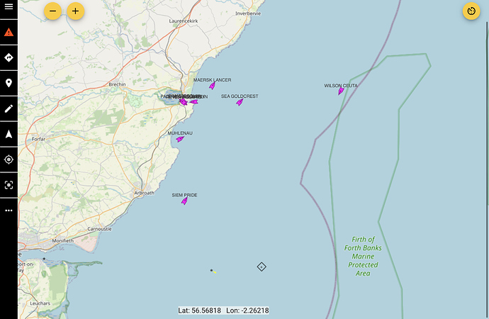
Some pics from my setup this morning…

OpenCPN - part of OpenPlotter

Freeboard Web interface served by SignalK server (part of OpenPlotter)

3 Likes

Damnit, now I have a task for this weekend! :smiley:

/edit @SweetPea11 I’m waiting for them to send me the link to download the image. Also, your link to the website doesn’t work, it has a trailing slash which causes a 404 error. The working link is https://www.sarcnet.org/ais-receiver.html

2 Likes