
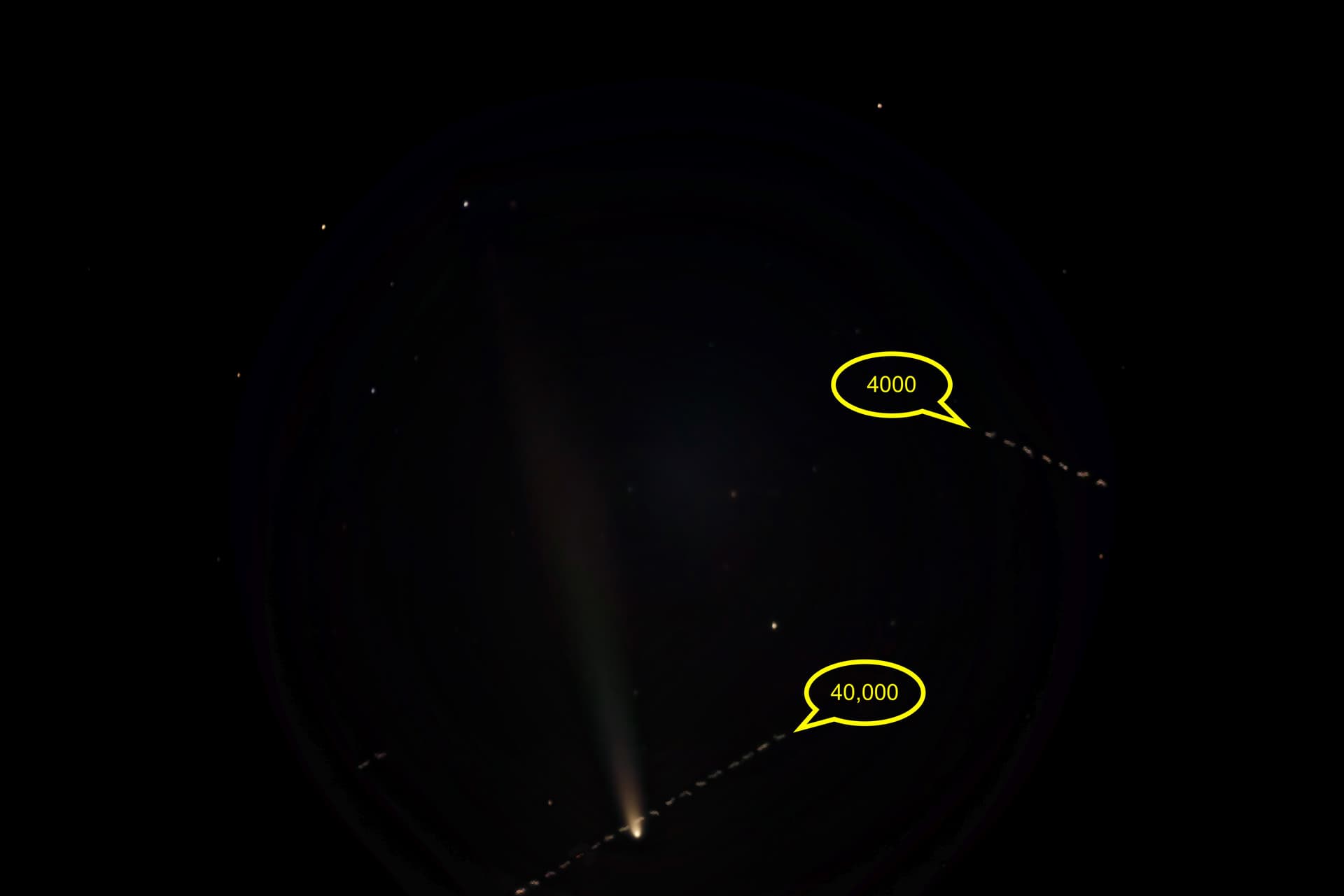
I took this photo of the comet last night from Mt. Bonnell, in Austin. My camera’s clock is accurate to within a second, which is relevant for comparing to ADS-B messages. I figured the lower track crossing the comet was probably SWA 3069. The time was 8:05:54 CDT on the evening of 14 October 2024. At that time, it looks like that flight was about 48 miles from my position. The 40,000 feet really means FL400 and we have high pressure now, so the plane is likely higher than that, but not by much. Doing some trig. I calculate an apparent altitude of about 8.8 degrees above the horizon (altitude at Mt. Bonnell from my position is about 750 feet).
Stellarium calculates the apparent altitude of the comet at about 10.8 degrees, or about 2 degrees higher than the calculation using trig. Atmospheric refraction would also make the plane seem higher than it is, but I think that is far less than 2 degrees. Looking at traffic around the time, I don’t see any other traffic that is a better fit, though.
Did I make some error in my calculations? I’m assuming ADS-B messages are reasonably accurate in position and time for the purpose of this exercise. Is that a reasonable assumption? At this position, I’m pretty sure the FA data is not MLAT.
Curvature of the earth would make the plane seem lower, not higher, so I’ve omitted that.