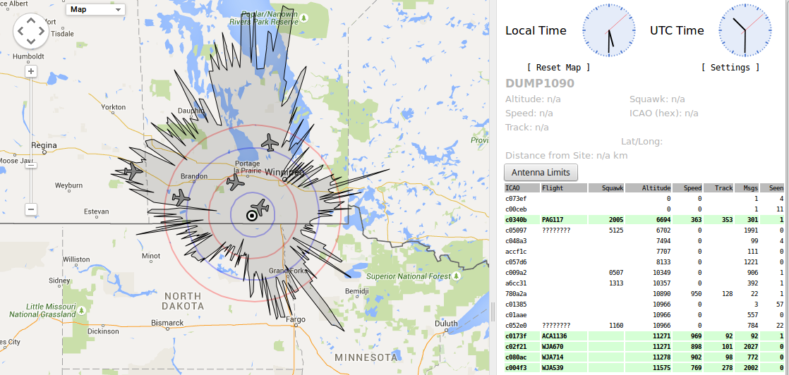
FYI: I’ve spent a few days improving my code. The logic is simpler and more robust. An email is now also generated when the aircraft leaves the detection zone. Here is a sample of what one of these emails looks like:
ALERT: Aircraft Leaving Dectection Zone: JBU63 10.1 km

2015-07-28T12:19:28.975000-05 ICAO=A849AB FLIGHT=JBU63 LATITUDE=49.27007° LONGITUDE=-98.16883° ELEVATION=10973m DISTANCE=10.1km AZIMUTH=341.6° ALTITUDE=46.5°

http://flightaware.com/live/flight/JBU63

2015-07-28T12:18:26.469000-05,A849AB,JBU63,49.20406,-97.99206,10980,9.9,76.9,47.1
2015-07-28T12:18:26.469000-05,A849AB,JBU63,49.20406,-97.99206,10980,9.9,76.9,47.1
2015-07-28T12:18:28.460000-05,A849AB,JBU63,49.20618,-97.99769,10980,9.6,75.0,48.0
2015-07-28T12:18:28.890000-05,A849AB,JBU63,49.20662,-97.99889,10980,9.5,74.6,48.3
2015-07-28T12:18:29.351000-05,A849AB,JBU63,49.20712,-98.00023,10980,9.4,74.1,48.6
2015-07-28T12:18:29.931000-05,A849AB,JBU63,49.20772,-98.00185,10980,9.3,73.5,48.9
2015-07-28T12:18:30.391000-05,A849AB,JBU63,49.20822,-98.00312,10980,9.3,73.0,48.9
2015-07-28T12:18:32.272000-05,A849AB,JBU63,49.21024,-98.00847,10980,9.0,70.9,49.8
2015-07-28T12:18:33.392000-05,A849AB,JBU63,49.21138,-98.01164,10980,8.8,69.7,50.4
2015-07-28T12:18:34.333000-05,A849AB,JBU63,49.21239,-98.01424,10980,8.6,68.5,51.1
2015-07-28T12:18:36.323000-05,A849AB,JBU63,49.21451,-98.01987,10980,8.4,66.0,51.7
2015-07-28T12:18:37.304000-05,A849AB,JBU63,49.21554,-98.02269,10980,8.2,64.7,52.4
2015-07-28T12:18:38.354000-05,A849AB,JBU63,49.21664,-98.02565,10980,8.1,63.3,52.7
2015-07-28T12:18:39.345000-05,A849AB,JBU63,49.21768,-98.0284,10980,8.0,61.9,53.1
2015-07-28T12:18:39.845000-05,A849AB,JBU63,49.21824,-98.02985,10980,7.9,61.1,53.4
2015-07-28T12:18:39.914000-05,A849AB,JBU63,49.21824,-98.02985,10980,7.9,61.1,53.4
2015-07-28T12:18:40.915000-05,A849AB,JBU63,49.21935,-98.03284,10980,7.8,59.6,53.8
2015-07-28T12:18:41.375000-05,A849AB,JBU63,49.21985,-98.03417,10980,7.7,58.8,54.1
2015-07-28T12:18:41.915000-05,A849AB,JBU63,49.2204,-98.03565,10980,7.7,58.0,54.1
2015-07-28T12:18:42.496000-05,A849AB,JBU63,49.22104,-98.03734,10980,7.6,57.1,54.5
2015-07-28T12:18:42.895000-05,A849AB,JBU63,49.22145,-98.03847,10980,7.5,56.4,54.8
2015-07-28T12:18:44.277000-05,A849AB,JBU63,49.22292,-98.04234,10980,7.4,54.2,55.2
2015-07-28T12:18:44.837000-05,A849AB,JBU63,49.22351,-98.04396,10980,7.3,53.2,55.6
2015-07-28T12:18:45.027000-05,A849AB,JBU63,49.22351,-98.04396,10980,7.3,53.2,55.6
2015-07-28T12:18:45.408000-05,A849AB,JBU63,49.2241,-98.04553,10980,7.3,52.3,55.6
2015-07-28T12:18:46.318000-05,A849AB,JBU63,49.22507,-98.04812,10980,7.2,50.7,55.9
2015-07-28T12:18:46.762000-05,A849AB,JBU63,49.22552,-98.04939,10980,7.2,49.9,55.9
2015-07-28T12:18:47.308000-05,A849AB,JBU63,49.22611,-98.05095,10980,7.1,48.9,56.3
2015-07-28T12:18:47.868000-05,A849AB,JBU63,49.22666,-98.05247,10980,7.1,48.0,56.3
2015-07-28T12:18:48.328000-05,A849AB,JBU63,49.22718,-98.05385,10980,7.1,47.1,56.3
2015-07-28T12:18:48.909000-05,A849AB,JBU63,49.22778,-98.05544,10980,7.0,46.0,56.7
2015-07-28T12:18:49.479000-05,A849AB,JBU63,49.22836,-98.05706,10980,7.0,45.0,56.7
2015-07-28T12:18:50.099000-05,A849AB,JBU63,49.22836,-98.05706,10980,7.0,45.0,56.7
2015-07-28T12:18:50.440000-05,A849AB,JBU63,49.22937,-98.05974,10980,6.9,43.2,57.1
2015-07-28T12:18:50.839000-05,A849AB,JBU63,49.22983,-98.06094,10980,6.9,42.4,57.1
2015-07-28T12:18:51.359000-05,A849AB,JBU63,49.23038,-98.06242,10980,6.9,41.4,57.1
2015-07-28T12:18:53.310000-05,A849AB,JBU63,49.23239,-98.06794,10980,6.8,37.6,57.4
2015-07-28T12:18:54.381000-05,A849AB,JBU63,49.23354,-98.07094,10980,6.8,35.5,57.4
2015-07-28T12:18:54.801000-05,A849AB,JBU63,49.23399,-98.07213,10980,6.8,34.6,57.4
2015-07-28T12:18:54.941000-05,A849AB,JBU63,49.23399,-98.07213,10980,6.8,34.6,57.4
2015-07-28T12:18:56.362000-05,A849AB,JBU63,49.23564,-98.0765,10980,6.7,31.5,57.8 *** CLOSEST APPROACH ***
2015-07-28T12:18:57.232000-05,A849AB,JBU63,49.23653,-98.079,10980,6.7,29.8,57.8 *** CLOSEST APPROACH ***
2015-07-28T12:18:58.412000-05,A849AB,JBU63,49.23779,-98.08232,10980,6.7,27.4,57.8 *** CLOSEST APPROACH ***
2015-07-28T12:18:59.503000-05,A849AB,JBU63,49.23894,-98.08544,10973,6.8,25.2,57.4
2015-07-28T12:18:59.893000-05,A849AB,JBU63,49.23894,-98.08544,10973,6.8,25.2,57.4
2015-07-28T12:19:01.664000-05,A849AB,JBU63,49.24123,-98.0915,10973,6.8,20.9,57.4
2015-07-28T12:19:02.194000-05,A849AB,JBU63,49.24179,-98.09302,10973,6.8,19.9,57.4
2015-07-28T12:19:02.714000-05,A849AB,JBU63,49.24231,-98.09454,10973,6.9,18.8,57.0
2015-07-28T12:19:03.124000-05,A849AB,JBU63,49.24274,-98.09566,10973,6.9,18.1,57.0
2015-07-28T12:19:03.625000-05,A849AB,JBU63,49.24329,-98.09714,10973,6.9,17.1,57.0
2015-07-28T12:19:04.135000-05,A849AB,JBU63,49.24384,-98.09851,10973,6.9,16.1,57.0
2015-07-28T12:19:05.166000-05,A849AB,JBU63,49.24493,-98.10143,10973,7.0,14.2,56.7
2015-07-28T12:19:06.758000-05,A849AB,JBU63,49.24659,-98.10596,10973,7.1,11.2,56.3
2015-07-28T12:19:07.857000-05,A849AB,JBU63,49.24775,-98.10907,10973,7.2,9.3,55.9
2015-07-28T12:19:08.868000-05,A849AB,JBU63,49.24883,-98.11192,10973,7.3,7.5,55.6
2015-07-28T12:19:09.437000-05,A849AB,JBU63,49.24943,-98.11355,10973,7.3,6.5,55.6
2015-07-28T12:19:10.027000-05,A849AB,JBU63,49.25006,-98.11523,10973,7.4,5.5,55.2
2015-07-28T12:19:10.508000-05,A849AB,JBU63,49.25056,-98.11657,10973,7.4,4.7,55.2
2015-07-28T12:19:11.047000-05,A849AB,JBU63,49.25111,-98.11812,10973,7.5,3.8,54.8
2015-07-28T12:19:12.039000-05,A849AB,JBU63,49.25217,-98.12092,10973,7.6,2.2,54.5
2015-07-28T12:19:12.598000-05,A849AB,JBU63,49.25278,-98.12251,10973,7.7,1.4,54.1
2015-07-28T12:19:13.129000-05,A849AB,JBU63,49.25336,-98.12397,10973,7.7,0.6,54.1
2015-07-28T12:19:13.579000-05,A849AB,JBU63,49.2538,-98.12526,10973,7.8,359.9,53.8
2015-07-28T12:19:14.139000-05,A849AB,JBU63,49.25441,-98.12685,10973,7.8,359.0,53.8
2015-07-28T12:19:14.679000-05,A849AB,JBU63,49.25497,-98.12836,10973,7.9,358.2,53.4
2015-07-28T12:19:15.220000-05,A849AB,JBU63,49.25557,-98.12988,10973,8.0,357.5,53.1
2015-07-28T12:19:16.290000-05,A849AB,JBU63,49.2567,-98.13291,10973,8.1,355.9,52.7
2015-07-28T12:19:16.781000-05,A849AB,JBU63,49.2572,-98.13429,10973,8.2,355.3,52.4
2015-07-28T12:19:17.181000-05,A849AB,JBU63,49.25762,-98.13545,10973,8.2,354.7,52.4
2015-07-28T12:19:18.191000-05,A849AB,JBU63,49.25871,-98.13833,10973,8.4,353.4,51.7
2015-07-28T12:19:18.742000-05,A849AB,JBU63,49.25925,-98.13986,10973,8.4,352.7,51.7
2015-07-28T12:19:19.221000-05,A849AB,JBU63,49.25976,-98.14123,10973,8.5,352.0,51.4
2015-07-28T12:19:19.862000-05,A849AB,JBU63,49.25976,-98.14123,10973,8.5,352.0,51.4
2015-07-28T12:19:20.282000-05,A849AB,JBU63,49.26093,-98.14419,10973,8.7,350.8,50.7
2015-07-28T12:19:21.322000-05,A849AB,JBU63,49.262,-98.14716,10973,8.8,349.5,50.4
2015-07-28T12:19:21.764000-05,A849AB,JBU63,49.26246,-98.14839,10973,8.9,349.0,50.1
2015-07-28T12:19:22.342000-05,A849AB,JBU63,49.26307,-98.15005,10973,9.0,348.3,49.8
2015-07-28T12:19:22.753000-05,A849AB,JBU63,49.26352,-98.15122,10973,9.0,347.9,49.8
2015-07-28T12:19:23.163000-05,A849AB,JBU63,49.26395,-98.15236,10973,9.1,347.4,49.5
2015-07-28T12:19:23.643000-05,A849AB,JBU63,49.26446,-98.15373,10973,9.2,346.9,49.2
2015-07-28T12:19:25.053000-05,A849AB,JBU63,49.26595,-98.1577,10973,9.4,345.4,48.5
2015-07-28T12:19:26.013000-05,A849AB,JBU63,49.26695,-98.16045,10973,9.6,344.4,47.9
2015-07-28T12:19:26.494000-05,A849AB,JBU63,49.26746,-98.16179,10973,9.7,344.0,47.7
2015-07-28T12:19:27.474000-05,A849AB,JBU63,49.26851,-98.1646,10973,9.8,343.0,47.4
2015-07-28T12:19:28.014000-05,A849AB,JBU63,49.26906,-98.16615,10973,9.9,342.5,47.1
2015-07-28T12:19:28.465000-05,A849AB,JBU63,49.26954,-98.1674,10973,10.0,342.1,46.8

Closest approach: 6.7km
